


DAVENPORT PCT 52, Scott County, Iowa
About
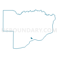
Outline

Summary
| Unique Area Identifier | 583397 |
| Name | DAVENPORT PCT 52 |
| County | Scott County |
| State | Iowa |
| Area (square miles) | 0.38 |
| Land Area (square miles) | 0.38 |
| Water Area (square miles) | 0.00 |
| % of Land Area | 100.00 |
| % of Water Area | 0.00 |
| Latitude of the Internal Point | 41.53666830 |
| Longtitude of the Internal Point | -90.57939700 |
Maps


Graphs
Select a template below for downloading or customizing gragh for DAVENPORT PCT 52, Scott County, Iowa


Neighbors
Neighoring Voting District (by Name) Neighboring Voting District on the Map
- DAVENPORT PCT 32, Scott County, IA
- DAVENPORT PCT 33, Scott County, IA
- DAVENPORT PCT 34, Scott County, IA
- DAVENPORT PCT 44, Scott County, IA
- DAVENPORT PCT 51, Scott County, IA
- DAVENPORT PCT 53, Scott County, IA
- DAVENPORT PCT 72, Scott County, IA
Top 10 Neighboring County Subdivision (by Population) Neighboring County Subdivision on the Map
Top 10 Neighboring Place (by Population) Neighboring Place on the Map
Top 10 Neighboring Unified School District (by Population) Neighboring Unified School District on the Map
Top 10 Neighboring State Legislative District Lower Chamber (by Population) Neighboring State Legislative District Lower Chamber on the Map
Top 10 Neighboring State Legislative District Upper Chamber (by Population) Neighboring State Legislative District Upper Chamber on the Map
Top 10 Neighboring 111th Congressional District (by Population) Neighboring 111th Congressional District on the Map
Top 10 Neighboring Census Tract (by Population) Neighboring Census Tract on the Map
- Census Tract 113, Scott County, IA (3,969)
- Census Tract 114, Scott County, IA (2,676)
- Census Tract 106, Scott County, IA (2,422)
- Census Tract 118, Scott County, IA (2,348)
- Census Tract 107, Scott County, IA (1,527)